Korean Summers Are Changing: Why Torrential Rains, Heat Waves, and Tropical Nights Are Happening All at Once
 \n
\n
Summer Weather Turned Common Sense Upside Down: Why Is the City Getting Hotter Even as Rain Pours Down?
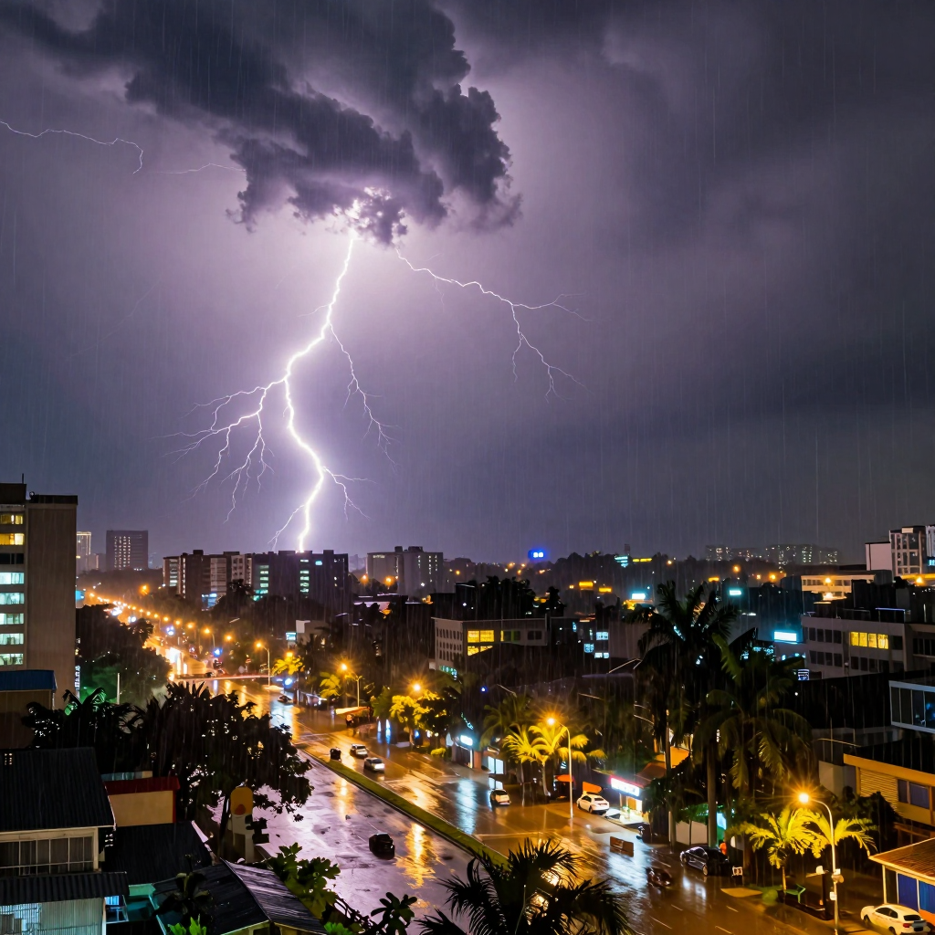
Torrential rain is pounding outside the window, yet the “feels-like” temperature on your phone reads 34°C. Even with an umbrella, your clothes get soaked, and once the rain stops, the air seems to cling to your skin with even greater weight. It is a scene that shatters the summer assumption that “rain makes things cooler.”
Summer in South Korea in 2026 is not simply a season of heat or heavy rain. It is closer to a season of “torrential rain in a steamy heatwave,” with downpours, high temperatures, high humidity, and tropical nights arriving all at once.
Rain can temporarily lower the temperature. But when warm, humid air continues to flow in from the south, the story changes. The more water vapor there is in the air, the less efficiently sweat evaporates, making it harder for the body to cool itself. That is why the apparent temperature can soar to 34–35°C even when the actual temperature is around 30°C.
Cities intensify this phenomenon in particular. Asphalt and concrete release the heat they absorbed during the day well into the night, while heat from buildings, vehicles, and air-conditioning systems adds to it. Even after the rain passes, cities do not cool down easily. This is the backdrop to the prolonged tropical nights in which the overnight low fails to fall below 25°C.
Localized downpours make matters even more complicated. Even under the same weather forecast, one area may experience only a brief shower while another faces intense hourly rainfall and the risk of flooding. While more than 100–200 mm of rain may be concentrated in the south, heatwave advisories can remain in effect elsewhere. These days, simply knowing that “it will rain today” is no longer enough to judge what the day will bring.
Weather in this era is no longer just everyday information to be handled with a single umbrella. It has become a real-time risk capable of changing commutes, travel plans, outdoor activities, sleep, and health. That is why, rather than taking rain as a sign of relief, you need to check rainfall intensity, the feels-like temperature, and nighttime temperatures together.
Under the Same Sky, Completely Different Weather Unfolds
A forecast that simply says, “Rain is expected nationwide today,” is no longer enough. On the very same day, Seoul may see nothing more than a brief shower, while torrential rain exceeding 200 mm could pour down along the southern coast and around Jirisan Mountain. Summer weather across the Korean Peninsula has entered a phase where it is no longer safe to assess conditions through a single, nationwide summary.
The differences are clear even in the forecast for the Liberation Day holiday weekend. Seoul and Gyeonggi, inland areas of Gangwon, and the Chungcheong region are expected to receive roughly 5–50 mm of rain, while Busan, Ulsan, Gyeongsangnam-do, and the southern coast could see 50–150 mm, with some areas forecast to receive more than 200 mm of extremely heavy rain. The phrase “rain is expected” may be the same, but the actual level of danger can range from simply bringing an umbrella to preparing for flooding and landslides.
The key factors behind these differences are hot, humid air flowing in from the south and narrow channels of moisture that form in specific areas. When a band of rain clouds remains over one location for an extended period, record-breaking rainfall can accumulate in a short time. Meanwhile, just a few dozen kilometers away, the rain may be light—or the skies may briefly clear before oppressive heat returns.
What matters now is not the “national weather,” but the hour-by-hour weather where I am and where I’m headed.
This is especially important on days involving frequent travel, such as vacations, camping trips, visits to family, and outdoor events. Checking only the forecast for your departure point is not enough. You should also review heavy-rain alerts, radar images, and ultra-short-term forecasts for the destination and along the travel route. In areas such as the southern region, where intense rain may be concentrated, it is safer to avoid approaching valleys and streams and to check road closures and traffic conditions in advance.
Localized rainfall does not simply mean that forecasts have become more complicated. It means we have entered an era in which, beneath the same sky, one person may be enduring humid heat while another must prepare for sudden flooding and strong winds. The way we read today’s weather must now become more precise—not “nationwide,” but “our neighborhood, right now.”
The Invisible Moisture Corridor Fueling Torrential Rain: A Warning Sign from the Weather
When record-breaking rain pours down over a small area in a short period of time, it is not simply a passing shower. It is the result of a massive, invisible moisture corridor forming in the sky. This same flow lies behind the recent concentration of heavy rain in South Korea’s southern regions and along the southern coast during summer.
Moisture evaporated from the warm seas to the south flows into the Korean Peninsula on southwesterly winds. When this humid air meets a stationary front, a low-pressure system, or mountainous terrain, it gathers in one place and rapidly intensifies. In areas where mountains meet the sea—such as the southern coast and the vicinity of Jirisan Mountain—the air is forced upward, causing rain clouds to grow even more powerful.
As Moisture Gathers, Rain Clouds Become Shorter-Lived and More Intense
Warm air can hold more moisture than cold air. As temperatures rise, the amount of water vapor in the atmosphere increases, along with the volume of rain that clouds can release all at once when they form.
For this reason, recent weather is often taking the following form rather than falling as “gentle rain throughout the day”:
- Torrential rain of several dozen millimeters per hour or more is concentrated in only certain cities or counties.
- Even within the same province, one area faces a growing risk of flooding while another receives only light rain.
- Rain bands develop earlier than forecast or shift from their predicted paths.
- High humidity remains even after the rain stops, making the heat feel more intense.
Forecasts calling for 50–150 mm of rain in southern regions and more than 200 mm along the southern coast and in mountainous areas are more likely when this supply of moisture continues. It is as though fuel is being constantly fed into the rain clouds, with humid air from the southern seas flowing in without pause.
The More Localized the Rain, the More Closely You Need to Monitor the Weather
The problem is that moisture corridors do not always form in the same places or at the same times. Depending on wind direction and speed, the position of the front, and the influence of terrain, powerful rain clouds can produce completely different outcomes just tens of kilometers apart.
That is why checking the weather forecast just once is not enough on days when torrential rain is expected. If you have plans to go out, travel, or drive, check precipitation radar and very-short-term forecasts together. When a heavy-rain advisory is issued, avoid traveling near rivers, through underground roads, or in low-lying areas.
An invisible moisture corridor may go unnoticed under ordinary conditions. But the moment it begins to collide with a front, normal summer weather can transform into a sudden cloudburst in an instant.
Weather Disasters That Continue Even After the Downpour
More and more days are seeing temperatures remain above 25°C even after a full day of torrential rain and well into the night. The water has drained from the roads, but the air feels even more humid and oppressive. The heat waves and tropical nights that arrive after heavy rain are no longer separate phenomena—they unfold as one prolonged disaster.
Living Conditions Become More Dangerous After the Rain Stops
Immediately after torrential rain, it is easy to think that flooding and landslides are the only dangers to worry about. In reality, the risks continue even after the rain has stopped.
- High humidity makes it harder for the body to regulate its temperature, making the same temperature feel far hotter.
- Wet roads and indoor spaces do not dry quickly, increasing the likelihood of mold, bacteria, and pests.
- Contaminated water and debris left behind in flooded areas can worsen hygiene problems and the risk of infection.
- Sudden clear skies and intense sunlight increase the risk of heat-related illnesses for recovery workers and outdoor laborers.
In other words, the end of heavy rain does not mean that it is safe. We need to develop the habit of watching for the next stage of changing weather.
The Health Burden Left by Heavy Rain, Heat Waves, and Tropical Nights
When temperatures rise in the humid air following rainfall, the body has difficulty releasing heat because sweat does not evaporate easily. As a result, the perceived temperature can rise above the actual temperature, while fatigue and dehydration may set in quickly.
Tropical nights—when nighttime temperatures remain at or above 25°C—especially take away the time the body needs to recover. Poor, shallow sleep can reduce concentration and immunity the next day, and place an even greater strain on people with cardiovascular or respiratory conditions. Children, older adults, pregnant women, and outdoor workers require especially careful attention.
Heavy rain brings daytime travel to a halt, while tropical nights interfere with nighttime recovery. Extreme summer weather disrupts the rhythm of the entire day.
Everyday Responses Must Change
Checking the weather has now gone beyond simply deciding whether to bring an umbrella. On days when rain is forecast, we must check not only the amount of precipitation but also the temperature and humidity after the rain stops, along with the possibility of heat-wave advisories and tropical nights.
The following measures can help in daily life:
- After torrential rain, first check access restrictions for underground spaces, riverside areas, and walking trails.
- Ventilate indoor spaces thoroughly, and dry wet clothing, bedding, and mats as quickly as possible.
- Use air conditioning appropriately, avoid keeping spaces sealed for long periods, and replenish fluids frequently.
- Avoid recovery work and outdoor activities during the hottest hours, and take an immediate break if you experience dizziness, headaches, or nausea.
- Before going to sleep, lower the indoor temperature and humidity to reduce the burden that tropical nights place on sleep.
In an era when heavy rain, heat waves, and tropical nights alternate with one another, what we need is not mere endurance. We need the ability to monitor rapidly changing weather in real time and adjust our plans on the assumption that the danger may continue.
We Need to Change the Way We Read the Weather
The days of simply checking whether it will rain tomorrow are over. The questions we need to ask now are more specific: What time will it rain, which neighborhoods will be affected, how intense will it be, and how long will it last?
Recent summer weather can vary even within the same city. It may be clear during the morning commute, only for dozens of millimeters of rain per hour to pour down on the way home. While one district faces a growing risk of flooding, another may see nothing more than a light shower. That is why it has become difficult to plan our schedules based on a single line that says “rain expected.”
Especially when torrential rain, extreme heat, and tropical nights overlap, weather forecasts must be read not as lifestyle information, but as real-time risk management information.
- Before going out, check very short-term forecasts in one- to three-hour intervals rather than relying only on the daily forecast.
- If a heavy rain advisory or warning is in effect, avoiding riverside trails, underpasses, and low-lying areas should take priority.
- Heat-wave alerts and the perceived temperature may matter more than the actual air temperature. When humidity is high, 32°C can feel like 35°C or higher.
- Check nighttime temperatures as well. A tropical night, when the lowest temperature stays above 25°C, can directly affect your condition and health the following day.
Reading the weather well from now on means more than simply remembering to bring an umbrella. It is closer to the ability to adjust your travel time, outdoor plans, trip itineraries, and health management in advance. During extreme summers, we need to develop the habit of asking not “Will it rain?” but “When will the place I’m in become dangerous, and how dangerous will it get?”
Comments
Post a Comment